GPS hunting maps for the West
Know exactly
where you
stand.
Public and private land boundaries you can bet a season on. Offline maps, tracking, and search built for hunters — across nine western states.
iPhone first. Free while in beta.
Built for the hunt.
Not a hiking app with a camo skin. Every feature exists because a hunter needed it in the field.
Public / private, settled
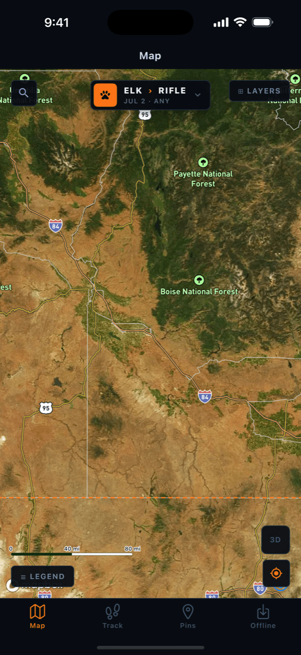
Every acre in all nine states is classified public or private — BLM, Forest Service, state, tribal, wilderness, and private parcels with owner names. Verified continuously against federal and county sources.
Offline everything
Draw a box, download it: satellite and topo tiles, land boundaries, roads, trails, and regulations. The backcountry has no bars. Pursuit doesn’t need them.
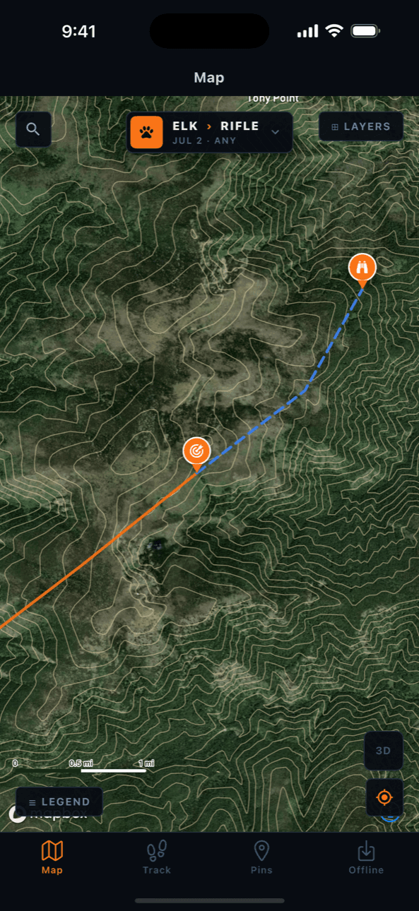
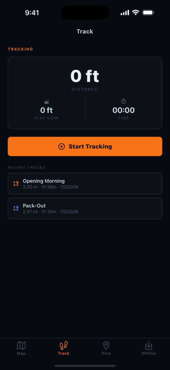
Track every mile
Record your route with live distance, elevation gain, and time. Pause at the glassing knob, resume on the pack-out, name it, and keep it forever.
Search like a local
Every peak, creek, ridge, saddle, trail, and forest road — over a million named places from USGS. Type “Elevator Mountain” and go.
Camps, trailheads & airstrips
Forest Service campgrounds, trailheads, and backcountry airstrips on the map. Plan the way in — and the way out — before you leave the truck.
Your pins, backed up
Pins, tracks, and folders sync to the cloud automatically. New phone, reinstall, lost in a river — your seasons of scouting come right back.
See conditions, not history
Yesterday’s satellite, on your phone
Every mapping app shows you the same years-old mosaic. Pursuit adds a daily satellite layer — dated, so you know exactly when it was taken. Check snow line, green-up, and burn scars before you fly in blind.
- ▸ Clear satellite for scouting detail
- ▸ Latest daily imagery with capture date
- ▸ True hybrid: satellite + contours + labels
- ▸ 3D terrain with rotate and tilt
From the field.
Beta hunters, real seasons.
“I archery hunted a unit I’d never set foot in. Pursuit showed me a public finger between two ranches that everybody else drove past. Called a 6-point bull into 38 yards on day two.”
“The offline maps saved our hunt. Three days behind the wilderness boundary with zero service, and I always knew exactly which side of the line we were on. That certainty is worth everything.”
“Flew into a backcountry strip for opening week. Used the daily satellite layer to check snow before we left — the clear imagery everyone else has was from July. We packed right because Pursuit knew.”
Nine states. Every acre.
Complete land ownership, roads, trails, and named places for the entire state — not just the famous units.
This season, hunt
with certainty.
Pursuit is in private beta on TestFlight. Spots open in waves — get on the list and we’ll send your invite.
Request a beta inviteiOS · Android coming later